
Alpine Lakes Wilderness, WA – West Fork Foss Lakes Trail Hike June 2016
Hiking The West Fork Foss Lakes Trail In Washington’s Alpine Lake Wilderness

View All Photos | West Fork Foss Lakes Youtube Video
- Location – Alpine Lakes Wilderness, WA
- Park Administration – Mt. Baker-Snoqualmie National Forest
- Trail Name – West Fork Foss Lakes Trail # 1064
- Fees & Permits – Northwest Forest pass required, or can pay $5/day for a day pass. You can get either pass at the US Ranger Station located here: 74920 Stevens Pass Hwy Skykomish, WA 98288. It’s on the north side of HWY 2 right about a half mile west of Foss River Rd, which takes you to the trailhead.
- Travel Logistics – Flew into Seattle, rented a Chevy Cruze
- Length Of Time Hiked – 4 Days, 3 Nights
- Miles Hiked – 20
- Trail Type – Out and back
- Trailhead – West For Foss River Trailhead
- Trail Difficulty – 6.5/10 (not including off-trail segments)
- Fires Allowed – No, not above 4000ft or at any of he lakes I passed
- Solitude – 6.5
- Scenic Beauty – 8
West Fork Foss Lakes Trail Maps
[sgpx gpx=”/wp-content/uploads/gpx/WestForkFossLakesTrailAllDaysOneTrack.gpx”]Pre-Hike
My work sent me out to Seattle for a conference, and I had the option to stay the weekend. This was my first trip to Washington state, and naturally I’m going to use that time to squeeze in a hike. A former co-worker had recently moved back to Seattle, and we planned to do this hike together. However, as with several of my past attempts to hike with a buddy, conflicting schedules and priorities meant I’d once again be hiking solo. While I totally understand and respect his decision to stay behind due to more important issues at hand, the fact remains; another hike with nobody to share the memories with.
Similar to my last hike in Arizona’s Sierra Ancha Wilderness, I’ve done much less research and planning on the are then I normally would. The big difference here is that I felt much more out of my element before the hike. While I have a fair amount of alpine hiking experience in Colorado, Utah and Wyoming, I’ve never been anywhere that had glaciers at 6000 feet. There are no snotel stations nearby at the 5000 foot mark, around the highest elevation this hike will see without any additional off-trail climbs I may decide to take on. Plus, all of my alpine hikes have been in late July or August, not late June. I set off on this adventure without any concrete knowledge of how much snow to expect at what elevation, although I felt pretty confident based on the little research I did that I’d be alright up to around 5000 feet. Still, the unknown awaits me.
Preliminary research showed that there was an avalanche that had blocked the road to the West Fork Foss River trailhead in February, which persisted into early June. A recent trip report on wta.org showed that the road had been cleared, but unfortunately the person who left the report had not actually hiked the trail to report on the snow pack conditions. Only 2 days before my hike, I learned that the avalanche debris had been cleared. Also, I discovered that the road would easily allow passage of a small car, even a Prius, despite the information on the forest service’s website about this road being for high clearance vehicles only.
Day 1 – Friday June 24th, 2106
Miles Hiked – 4.67
Elevation Gain – 2694′
Route – West Fork Foss River Trailhead to Copper Lake
I left the Seattle area in the early afternoon today and headed to the mountains. Once on Hwy 2 and east of Monroe, the drive was pretty scenic. I stopped into the US Ranger station on Hwy 2 in Skykomish to pick up a couple of day passes for parking at the trailhead. $5 bucks a day for anyone who doesn’t have a Northwest Forest Pass, which was $30.

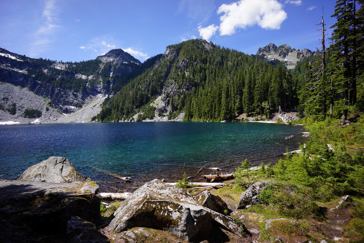
West Fork Foss River trailhead
The road to the West Fork Foss Lakes trailhead was cleared and smooth as any dirt road is going to get. It looked like they just left a bunch of the avalanche debris and turned it into a little hill to drive over. There were only a couple of small potholes, not large enough to cause any damage if one were to drive right over them at any speed. At the trailhead, there were about 12 cars. I was expecting there to be fewer cars here, considering the fact that it was raining and the trailhead had only been open a few weeks at most.
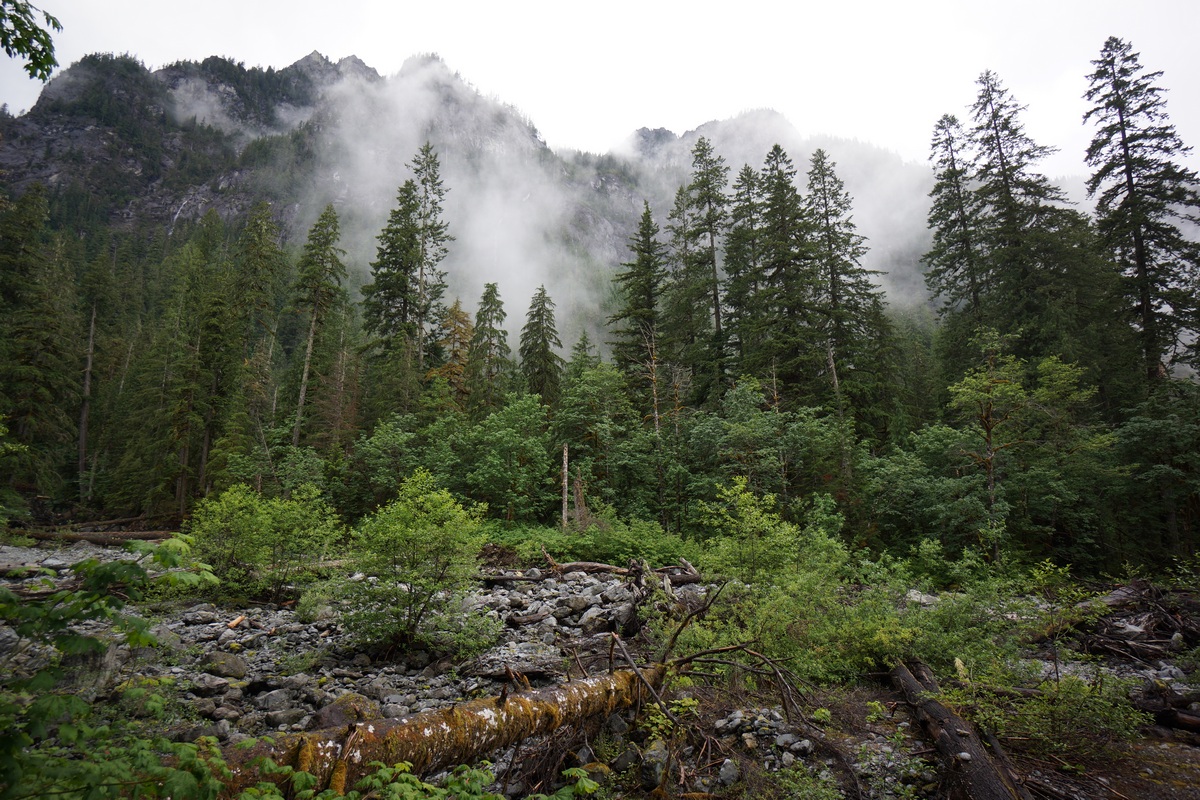
West Fork Foss River trail
I hit the trail at 5pm. The plan for today is to hike to Trout Lake, the first lake and last landmark before the trail begins it’s ascent towards Copper Lake. The trail starts out in a lush looking pine forest with lots of moss growing on the trees. It looked similar to what I envisioned the Olympic Peninsula to look like, but I’m sure it’s quite different.

West Fork Foss River
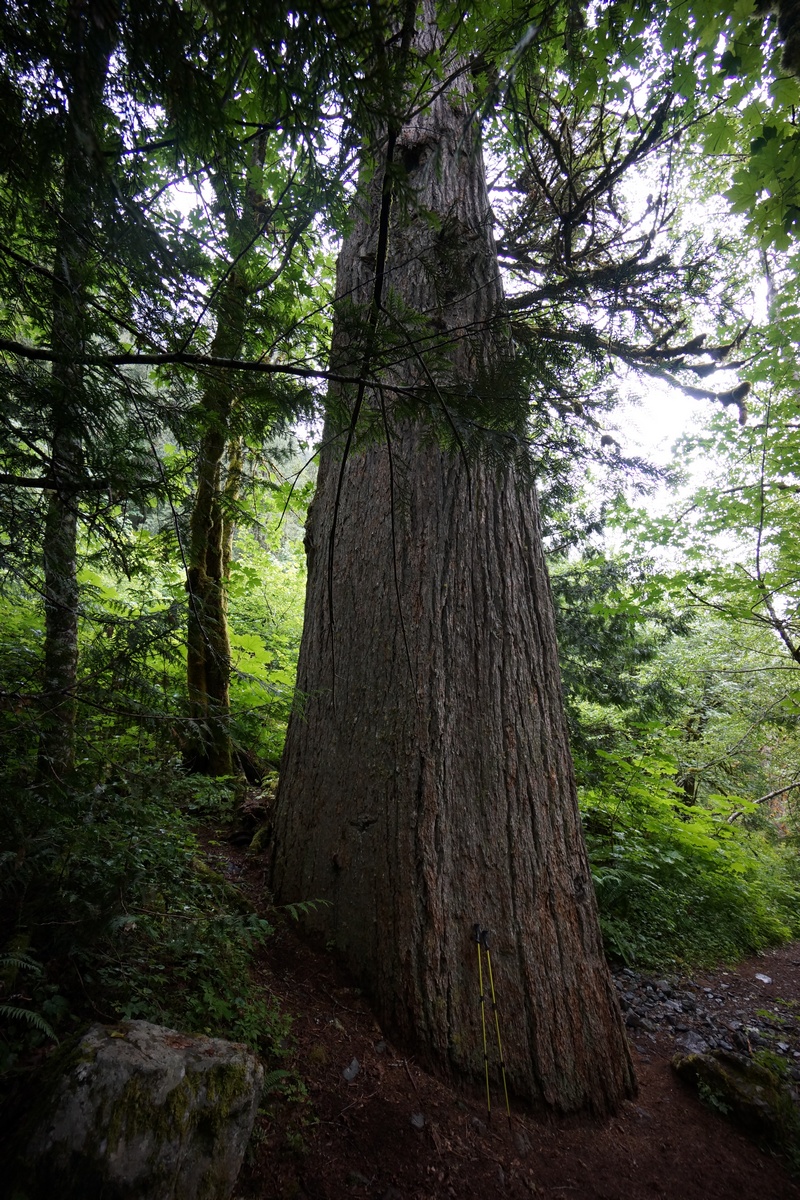
Huge old-growth tree
After a short while I reached the bridge crossing the West Fork Foss River. The water was flowing with some force and was quite loud. Some ways past the bridge I passed a huge pine tree, much larger than the others. This old-growth giant was obviously spared the ax when this area was logged in the past. Really impressive to see a tree of this size.
Trout Lake
Next up along the trail was Trout Lake. I went down to the shore line to snap a picture, but with all the clouds, it wasn’t that great. When I turned around I saw a tent in the woods just off the trail. I continued along the trail and saw many more tents, I estimate at least 10-12. So much for camping here tonight. Doesn’t looks like there was an open spot, even if I wanted to camp here. These people seemed not to care that they were camping just 50 feet from each other. It’s one thing if you’re part of a large group, but otherwise, why would you come all the way out here to camp within sight of another person? That’s not my idea of camping.
It was around 6pm now as I pushed on past Trout Lake and headed up towards Copper Lake. While I didn’t really want to make the hike up to Copper Lake tonight, I figure I’d have more time in the high country tomorrow and should be able to snag a good campsite tonight. Not long after leaving Trout Lake behind and starting the climb up the switchbacks, the brush along the trail started to choke the path. It was now impossible to avoid the wet brush lining the path, and before long what little of me was dry became soaking wet. Water was sloshing out of my shoes now. This was pretty crappy and not what I was wanting to get into just 1.5 hours from the car.

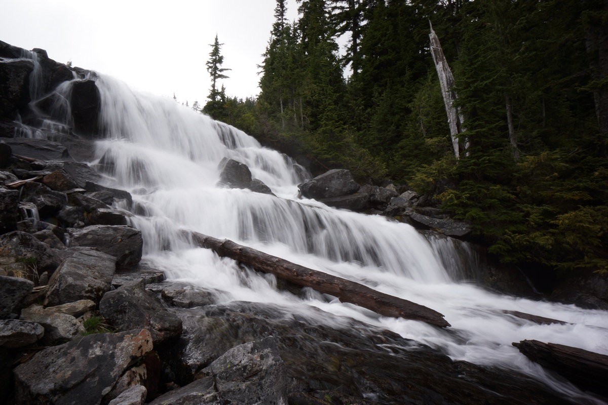
Waterfall below Copper Lake
There weren’t many views from the trail as it winded up to Malachite and Copper Lake. However, the sound of a waterfall was present much of the way and there were a couple of good views of it towards the top. This waterfall was coming from the Copper Lake outlet. There was a decent campsite that probably would have worked for my hammock too around 3500ft, but why stop here? Just a few hundred feet from the top now, I pushed on.
When I reached Copper Lake, I saw a sign for Toilet and a path leading off into the woods. Didn’t realize they had toilets up here. I’ve only seen them in a handful of places, typically where human impact is large. That must be the case here as well.
I passed two young girls cooking hot dogs in their tent vestibule as I searched the are for a campsite. It was now around 7:45 and I wanted to find a spot to hang before it gets too dark. It took a while to find the right pair of trees. I’m learning that finding good hammock sites can be tougher then tent spots. Let’s face it, all pre-existing campsites are generally flat and will accommodate a tent, but not all pre-existing sites have trees, let alone trees spaced the right distance apart and of the right size. Some of these trees were so large, I couldn’t even fit the hammock webbing around it!
Finally got my hammock and tarp set up just before dark. It’s been a while since I’ve set up the tarp over the hammock and that took me a good while. Just in time though as it did start raining a little bit right after I went to bed. It was a good hang and super comfy, so I had no trouble falling asleep tonight.
Day 2 – Saturday June 25th, 2016
Miles Hiked – 4.81
Elevation Gain – 1788′
Route – Copper Lake to Big Heart Lake
It rained a bit throughout the night but not very hard. Either way, nothing of mine dried out. The trees were drip-drying this morning and I didn’t feel motivated to leave the tent until 9am. Nothing like putting on soaking wet shoes and socks when it’s 45 degrees out! It took a while to break down everything this morning with all my gear being wet, and I didn’t get on the trail this morning til around 10:15.
Unfortunately the weather was still looking crappy this morning. The forecast all week had been calling for rain Friday with it clearing overnight, leaving the rest of the weekend to be rather nice and sunny. So far, just clouds, and looks like it might rain at some point.


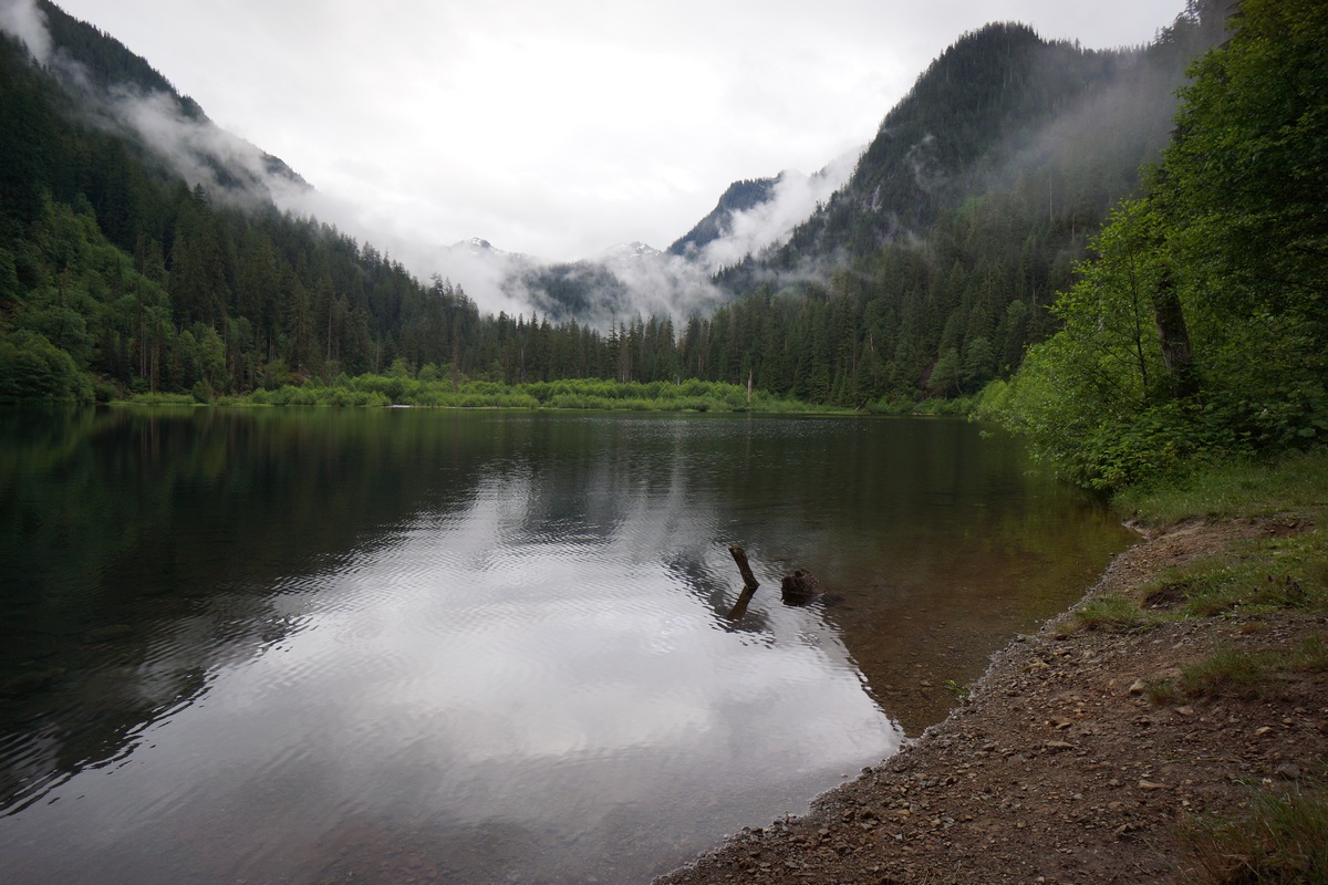
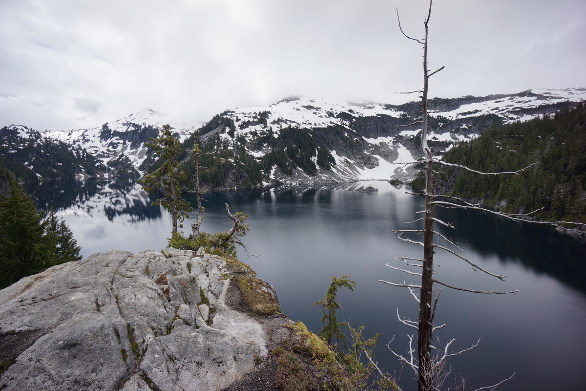
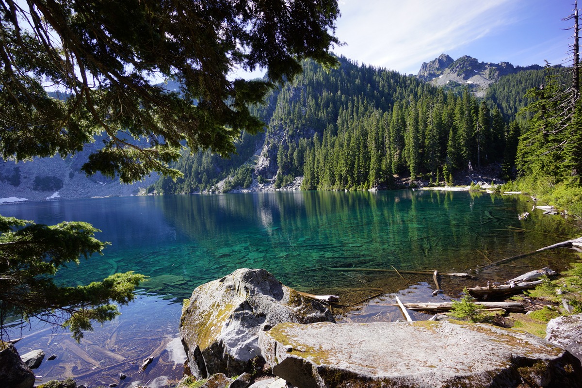
Copper Lake
I worked my way around Copper Lake, which looked like it would have been much more picturesque under blue skies. I didn’t see many good, obvious campsites the rest of the way around the lake. I was looking because I may decide to camp here again on the way back. After all, I didn’t really get to experience this lake at all since I’ve been here.

Little Heart Lake
The trail winds away from the lake towards the north end, and off into the woods. It was a short hike over to Little Heart Lake from here. The stream outlet was jammed with logs like the others, and provided one of the better views of the lake in the immediate area of the trail.

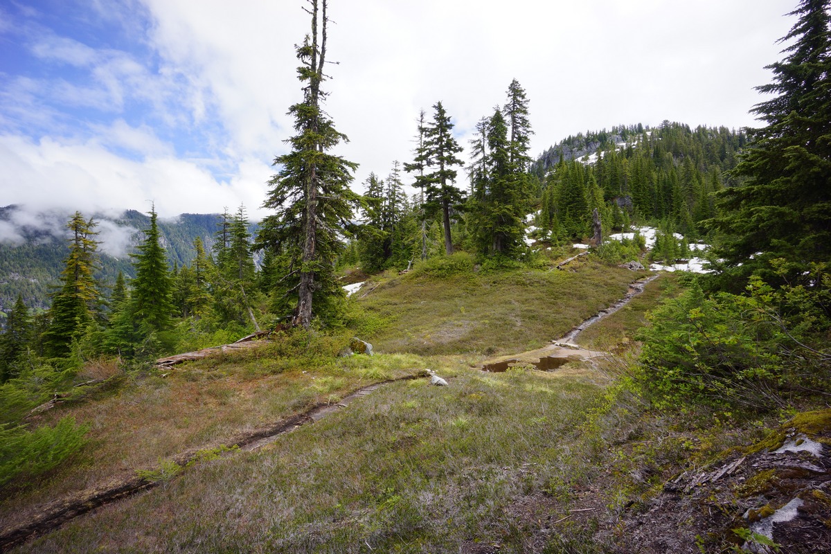
Moving on past Little Heart Lake, I started to encounter more downed trees. One was particularly large and kinda difficult to get past. After that, the trail continued to climb up over a small ridge. The thick cloud cover prevented any real views from breaks in the trees up here. In this area, I saw the first snow along the trail around the 4400ft mark. The trail along this ridgeline tops out around 4925ft before descending down towards Big Heart Lake. After a few switchbacks, the trail levels out and enters a little meadow littered with fallen rocks from the cliffs above. I ended up camping along a hill above this meadow later tonight, but at this moment I hiked right past it.

First views of Big Heart Lake
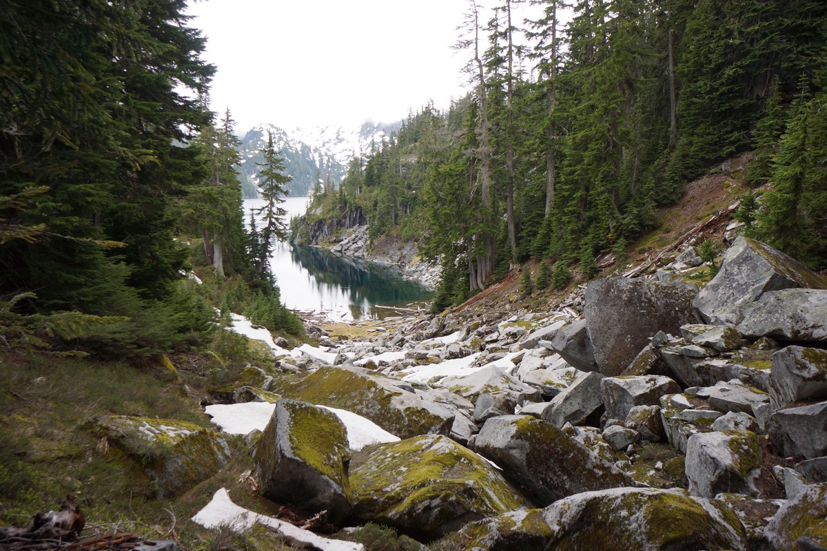
After roughly 2 miles from Little Heart Lake, I reached Big Heart Lake. There was a nice campsite sitting just above the lake’s outlet on the north side. At the moment though, it was occupied. I kept moving and made my way down to Big Heart Lake’s outlet. There was a huge logjam here that required crossing in order to continue along the lake. These were huge logs and pretty sturdy, which made for a simple crossing.
Waterfall pouring off Big Heart Lake
Now on the other side, I had a better look at the waterfall that is the result of Big Heart Lake basically pouring off a cliff. After a quick look and a few pictures, I moved on. I figured I’ll be back through here later, and might as well wait until the skies clear up for better pictures.
Big Heart Lake
I continued up the trail along Big Heart Lake and found a couple of spots with sweeping views of the lake. Best views yet during this hike. Tons of mosquitoes up here though, but they’ve been pretty much everywhere.
Further up the trail I started hitting more snow. It wasn’t super deep, but my feet were occasionally punching through hollow spots in the snow. It was tough to keep sight of the trail at this point as well. I intended to try for Chetwoot Lake, but I decided to turn around and head back to Big Heart Lake and just try to dry out and enjoy the day, maybe do some fishing.
I headed back to the outlet area, and noticed that the prime campsite that was occupied earlier was now open. I dropped my pack here and laid claim to it, only to find out shortly after that my hammock would not fit between any of the trees here. Bummer. I spent the next hour at least trying to find another spot to camp. It’s insane to me to come all the way out to a place like this and take a campsite with no view of anything, but that’s what I ended up doing. The trees here make it very hard to hang a hammock since they’re so large. The spot I found was on a little hill at 4675ft overlooking that little meadow I mentioned earlier, on the extreme north end of Big Heart Lake.

Campsite near Big Heart Lake’s northern end
Followed this down to the lake from my campsite
My campsite was on a slope, which kind of sucks for a campsite, but it works when you have a hammock. After getting camp squared away, I headed down to the lake to do some fishing. From my campsite, there was a boulder field leading downhill towards a protected cove on the very northern tip of the lake. I worked my way around the west side of the cove and found a couple of nice boulders to sit on and fish from.

Fishing on Big Heart Lake

I didn’t see any fish in this corner of the lake. I’m sure there would be more by the logjam at the outlet, but it also looked pretty snaggy. The color of the water was that deep, vibrant blue which happened to be clear as glass at the moment. Visibility in the water was high, and there was a nice reflection of the mountains on other portions of the water.
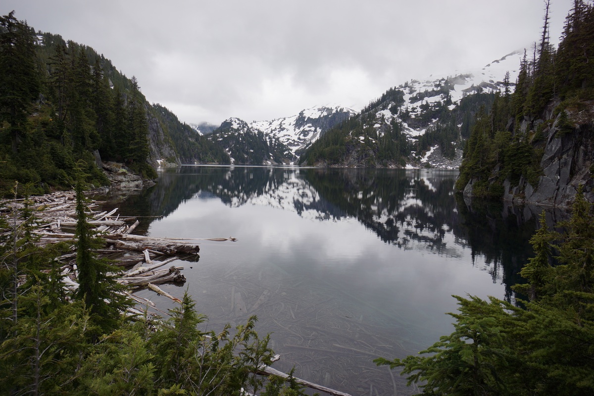
Big Heart lake near the outlet, view from the “prime campsite”
After heading back up to camp, I grabbed my camera gear and headed back down towards the waterfall. There now was a couple camped at the prime spot. The downside of this campsite is that the trail runs right through it. Not my problem now I guess.
Waterfall below Big Heart Lake

Delta Lake below
Now down at Big Heart Lake, I crossed the outlet and worked my way down the waterfall some more. It was pretty steep here, but I ended up descending more ground than I thought I could. This provided some cool views of the waterfall, although the grey sky was still washing out my photos.

I climbed back up to the lake outlet and continued up hill to some good vantage points I encountered earlier. However, all of these spots were now occupied with other campers, so I just headed back to camp for the night. I was getting tired of having soaking wet feet anyways.
For dinner I had a 100% whole wheat tortilla with cheddar cheese and pepperoni. I scarfed that, and was glad to have an appetite this time unlike some of my other hikes.
The sky started clearing up a little just as the sun set, through the trees and out of my direct sight. The sky was red and pink, it looked like an awesome sunset for someone else. For me, with no campfires allowed up here to keep the mosquitoes away or dry my wet shoes and clothes, I just headed to bed.
Day 3 – Saturday June 26th, 2016
Miles Hiked – 6.59
Elevation Gain – 2158′
Route – Big Heart Lake to Malachite Lake
I woke up at 2am to pee, and the stars were out and shining bright. When I got out of my hammock at 7, the sky was completely blue without a cloud in the sky. Finally! I was excited to have a day with some good weather to finally take full advantage of this beautiful area.
After packing up camp, I decided to head back up the ridgeline above Big Heart Lake towards Chetwoot Lake. I didn’t really intend to hike all the way to Chetwoot at this point, but I did want to get high enough to get a proper view. Up on this ridgeline, overlooking Angeline and Big Heart Lakes, should provide some of the best views of the hike.

Delta and Trout Lakes
On my way up the ridgeline towards Chetwoot, I passed a group of guys I talked to yesterday. They said they went up the ridge and descended halfway down to Angeline Lake. Well, I’m gonna check it out. Point 5359 seemed like a good destination, where I should find ample views.
I continued up the trail until it hit some snow patches and petered out. There were sets of footprints to follow though, so that helped. There was a faint footpath to follow much of the way from here on out, but it’d be real easy to lose it in some spots. It’s obviously not a maintained trail anymore.

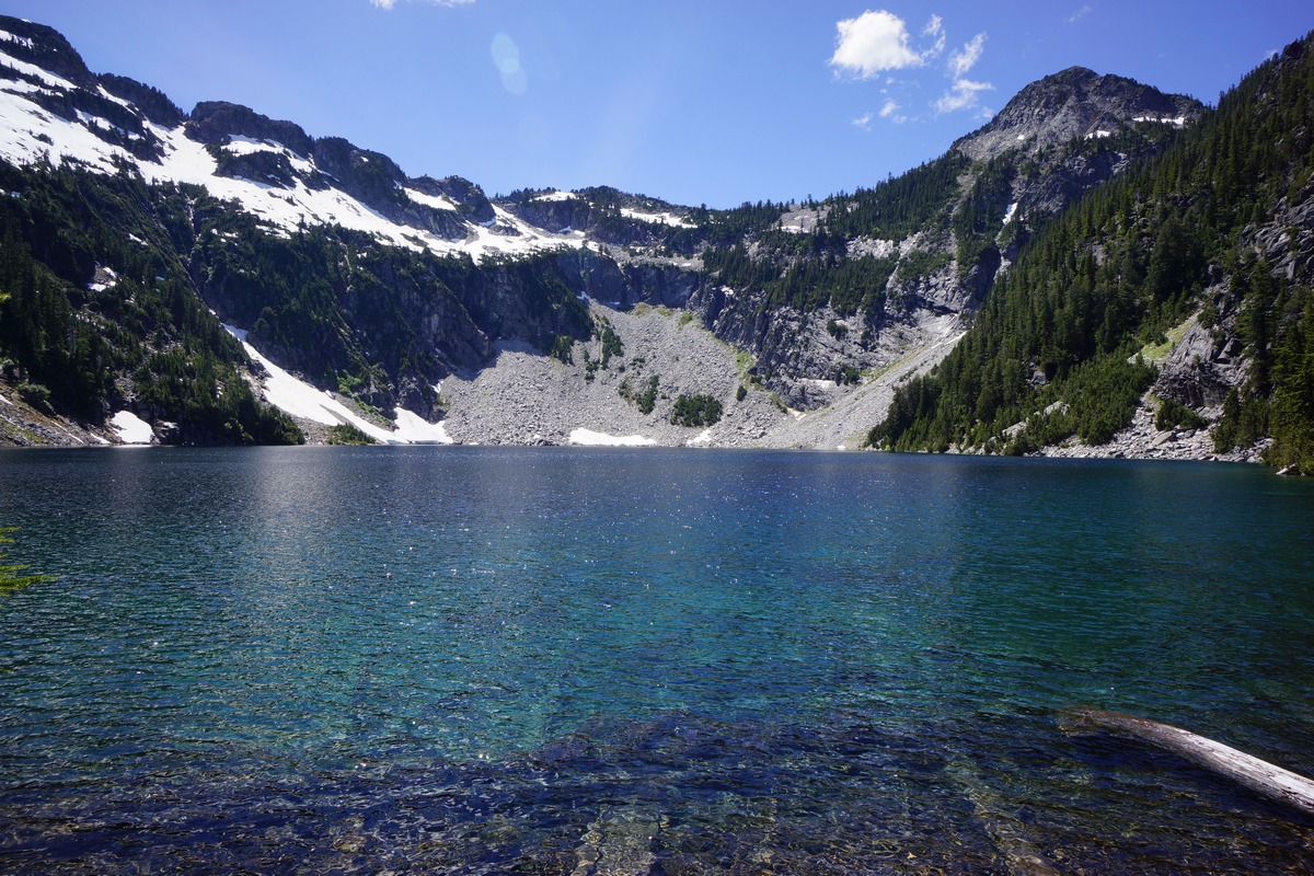
Angeline Lake
The path I followed had me working my way over a smaller ridge at around 5000′. On the other side, the path became very faint and I wasn’t sure if I was following an old game trail at one point, but as I made my way down a steep section the path reappeared. The path descends downhill a bit in the direction of Delta Lake, going as low as 4840′ or so before swinging back uphill. There were some cairns here and there to follow, but not everywhere they were needed. The path lead me to a cliff overlooking Angeline Lake, my first glimpse. Nice!

Angeline Lake
Snowy slopes below point 5359
The final push up to point 5359 had more snow. Even up here, the mosquitoes were relentless. I battled them up to the top, where I stopped at a small saddle before the actual summit. Great view, but still some trees in the way.

View of Big Heart Lake from point 5259

Looking north from point 5359 at Big Heart Lake
The climb up to the top of point 5359 was short and easy from here. This is a better vantage point, with less trees obstructing my view. I would have taken more pictures and stayed up here a while, but damn, those mosquitoes! I had to take multiple pictures of the same scene since they kept getting in front of my shot and showing up as a blurry spec. Alright, time to head down.
I was satisfied with making it this far. I could keep going towards Chetwoot, but it’s just going to be further out of the way of my destination tonight, which is Malachite Lake. Hopefully, there’ll be nobody up there.
Going down the patches of snow was harder than going up. Not bad, but slippery at times in my trail runners. I was able to dig in a heel as needed, the snow was pretty soft. Going back down through this area was a lot quicker than getting up here, it seemed. I was getting really warm now, and the mosquitoes were getting old. I was hiking with my headnet on now, which I don’t normally do unless absolutely necessary. And it was one of those times.

Big Heart Lake reflection
Nobody camping at Big Heart Lake now. I took a break at the prime campsite and ate a bit, but not much. I snapped a couple of nice pictures here at the lake now that the sun is up and the skies are blue. My goal now is to push on to Malachite Lake without any breaks (not dropping my pack).

Delta Lake below, Otter Lake up top. Waterfall below Angeline Lake barely viable on the right
The trail heads up some switchbacks now in between Big and Little Heart lakes. At the top of the ridge, there’s an overlook area just off the trail that I walked past yesterday, since there was no view of anything. Today though, I went to check it out. Here, there was a good view of Delta and Angeline Lakes, as well as the waterfall below Big Heart Lake’s outlet. The only problem is that I could not fit them all in the picture without falling off the cliff, as I was already leaning towards it to get the ones I did manage.

Little Heart Lake
I kept on towards Little Heart Lake. The fallen trees I encountered yesterday seemed a bit easier to manager today, moving downhill. I moved on past Little Heart Lake and towards Copper Lake, where I saw a guy fishing with his dog. He said he hadn’t had any luck, and that the fish weren’t rising at all. I thought about camping along Copper Lake too if the right campsite presented itself, but it didn’t. I did see a few more groups of people along the lake and figured it would be best to just keep moving and shoot for Malachite Lake. After all, it’s only about a half mile away now from the outlet of Copper Lake.

Copper Lake reflection

Copper Lake again
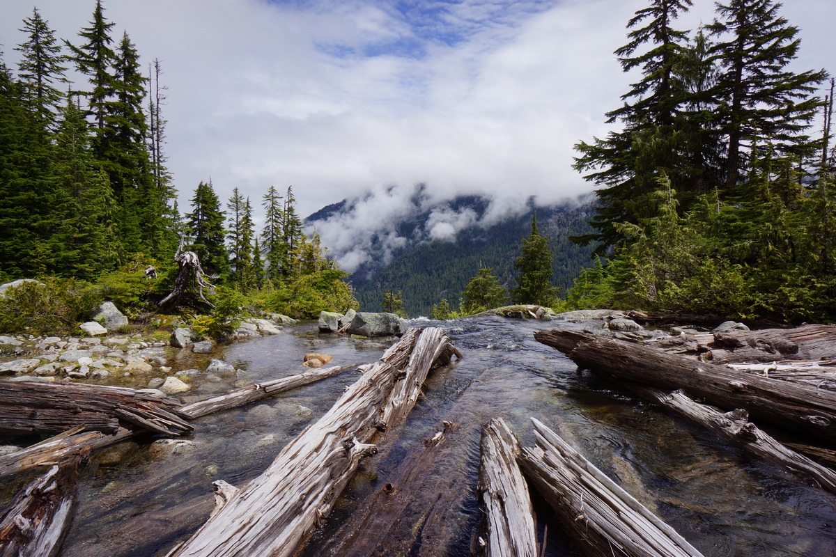
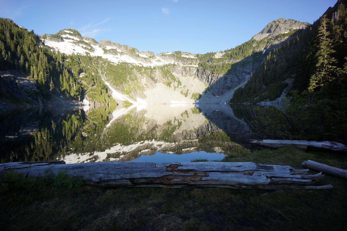
After crossing Copper Lake’s outlet, I started looking for a way to get up to Malachite Lake. I wasn’t sure what kind of trail there would be leading to the lake, but I was pretty certain there would be some type of blazed path somewhere. So far, the terrain looked pretty steep and didn’t see any signs of anything. Just when I was about to think that there was no trail, I saw a sign on a tree pointing towards the path to Malachite Lake. I didn’t see this on my way up.
The trail up to the lake was actually the steepest trail of the whole trip. Even though it was short, I was whopped by the time I got to the top. With that said, I was also very hot, hungry and thirsty which certainly were factors at play. The trail lead to the lake’s outlet, where I scouted the area for potential campsites. I followed the shoreline south and eventually found a pretty sweet spot to hang my hammock. And the best news is, I had this lake all to myself! Not another person in sight.

Malachite Lake campsite
Since it wasn’t going to rain (at least I hope not) tonight, I just set up the hammock without the tarp. It was tough finding a spot to hang, and the spot I chose just barely worked. I had less than 6 inches of play left on my hammock straps. The view from the hammock was really good though, just what I was hoping for.
Malachite Lake
After getting it all set up I went down to the lake to filter some water. I chugged a liter and filtered another. It was still fairly early in the afternoon, and so I decided to take a quick nap to recharge.
After waking up, I went and found the toilet that was near the lake’s outlet. There was a toilet at every lake up here, even Malachite. So, these toilets… it’s a wood box with no toilet seat. No way I’m sitting on that nasty wood. Hovering over this thing is not easy easy due to it’s shape. Fun stuff.
Now, on to the REAL fun stuff… fishing! Along the shoreline below my camp, the water was pretty shallow and had some downed logs, but fishable. I did see a couple of 6 or 7 inchers in there, but there wasn’t much action. This fish were hitting bugs on top of the water, but I didn’t have a fly rod with me. The few fish I did see were cruising the shallows. I didn’t have any luck farther out near the drop off.
I had only one bite this whole trip, and it was here at Malachite Lake on a Rebel Crickhopper, a grasshopper lure. I have used the brown color and the brown and fire tiger colors, and prefer the brown. Sounds goofy, but I’ve had lots of success with this lure in the past with bass, sunfish and trout and it’s one of only 5 or so lures I bring with me hiking. I ended up snagging my crickhopper on a log later and lost it. Gotta get another one!
After fishing I filtered more water and headed back to camp to seek shade. I had a pretty good view of the lake from camp, in the shade which was nice. I relaxed the rest of the day, alternating between the shoreline and my camp. I’m really grateful for the clear weather today as it really made this trip worth while.
I was running pretty low on food now, but fortunately had one more tortilla with cheese and pepperoni waiting for me in my bag. I went to bed just after the sunset, since I plan to get up early and get back to my car in the morning.
Day 4 – Saturday June 27th, 2016
Miles Hiked – 4.13
Elevation Gain – 320′
Route – Malachite Lake to West Fork Foss River Trailhead
I woke up at 5:30 this morning to a great view of Malachite Lake from my hammock. The night was clear and calm, and I slept well. This was a really nice way to end my hike here in the Alpine Lakes Wilderness! Without the tarp to put away, no need to filter water and no wet gear to contend with, leaving camp was quick this morning.
Reflection on Malachite Lake
The reflection on the lake was incredible, I just had to stop at the outlet to admire it a little longer. Sadly, I’ll be on a plane in a few hours heading back home.
I made quick time down the Malachite Lake trail down to the West Fork Foss Lakes trail and didn’t stop there. I stopped a couple of times near the top where views of the waterfall presented itself, but the lighting wasn’t great yet at this hour of the day. I just kept moving down as soon as possible, ready to get back to the car at this point.
Much of the brush along the trail was wet still from the morning dew, and I was pretty drenched by the time I made it down to Trout Lake. There was nobody camping here this time. I continued on towards the trailhead, with clean clothes, food and water my motivation.
Trout Lake
After leaving Trout Lake, I made great time getting back to the trailhead, arriving just after 8am. For reference, it took me about 1 hour 50 minutes to get down to West Fork Foss River trailhead from Malachite Lake. There were about 5 cars in the parking lot now.
Final Thoughts
The drive in to this area along Hwy 2 was beautiful. Looks like an awesome area to spend more time and explore, but it does seem to be very popular. I wasn’t expecting as many people, even though it wasn’t too insane.
I wish I brought mosquitoes repellent. Definitely bring a mosquito head net!
Think twice about bringing your hammock out here. It was a pain in the ass finding a place to hang from here due to the large tree sizes. Consider bringing longer straps if you insist on sleeping in a hammock. I don’t blame you, that’s my preference too.
The fishing was slow here. Maybe it’s the time of year? First time to Washington state, I have no idea. Either way, these lakes are hard to fish because lots of the shoreline is inaccessible. Cliffs and steep slopes butt up against deep water in many parts of these lakes. Oh and the cost of that damn fishing license was $28 bucks for 2 days for an out-of-stater like me. That’s why a lot of people choose not to buy them and take their chances. I try to do the right thing but damn, that’s the cost of an annual fishing license in Michigan, for 2 days of lousy fishing!
I’d like to come back here again, but probably in July or August. Maybe the mosquitoes aren’t so bad then. Plus, it would make traversing some of this terrain easier with less snow and mud.
North Country Trail Section Hike – Hwy 131 to Mesick, MI – Dec 2015

View All Photos | HD Video on Youtube
- Location – Pere Marquette State Forest, MI
- Trail – North Country Trail Section – Hwy 131 in Fife Lake to Mesick
- Fees and Permits: none
- Length Of Time Hiked – 2 days, 1 night
- Miles Hiked – 25+
- Trail Type – Point-to-point
- Starting Point – Roadside park along Hwy 131 in Fife Lake (closed in winter for parking!)
- Ending Point – 12/15 Rd Trailhead in Mesick
- Route Difficulty – 3
- Fires Allowed – Yes
- Solitude – 7 (For Michigan)
Maps
Below is my caltopo map I created before the hike.
Notes
I’ve hiked the High Country Pathway, Manistee River Loop, Nordhouse Dunes and the Jordan River Valley, which I consider to be the top hiking destinations in the lower peninsula. However, I have not hiked any segments of the North Country Trail yet, other than the west bank of the Manistee River where the NCT, along with the Manistee River trail, helps form the extremely popular Manistee River Loop. I found a segment of the NCT that sparked my interest, running from Hwy 131 south of Fife Lake to Mesick, and and chose that for a weekend getaway. There really isn’t much info in NCT section hiking in the lower peninsula. I only managed to dig up a couple trip reports with very limited pictures.
This hike ended up being 25-27 miles. I forgot my GPS so I don’t know the exact mileage. The North Country Trail is extremely well marked throughout and follows the Manistee River the whole way through this section, making it hard to get lost.
The challenge with this hike is logistics. It’s a point-to-point and requires a shuttle from one end to the other. Fortunately I was able to secure a ride from my car to my starting point at Hwy 131 to make this hike happen.
Saturday December 19th, 2015
I woke up around 5am today and made the 1 hour drive over to the town of Mesick with my shuttle ride following behind. After dropping my car off near the 12/15 Rd Trailhead on the north side of the Manistee River just east of M-37, we headed towards my starting point, where the Manistee River meets Hwy 131. First, we passed through the small town of Manton to stop for breakfast. Gotta get that last hot meal in before setting out into the cold!
After breakfast we continued north on Hwy 131 until we crossed the Manistee River. On the east side of the road just north of the river is a roadside park where you can pick up the NCT. However, the roadside park is closed for the winter. My ride dropped me off in front of the gate and I was on my own from here.
I walked through the parking lot towards the river and quickly picked up the trail. Heading south/west, the trail immediately runs underneath Hwy 131. It was in the teens today and windy, with some flurries in the air. After a short while of walking I was warmed up and ready to cover some miles.

Manistee River at Hwy 131 in Fife Lake where I started

The purpose of this hike was not only to get away and see this previously unexplored section of the Manistee River, but also to get a bunch of miles on my legs before my upcoming hike in Big Bend National Park in January 2016. I sprained my ankle in October and have been trying to slowly rehab it. After a few weeks of shorter walks, now is the time to do a more serious test and make sure I can handle a week in the desert.

The river has many, many bends like this along the trail

Not far after leaving Hwy 131 behind, I came across a campground, aptly named Old Us-131 State Forest Campground. Here, there was one car parked and some foot prints in the snow.

After passing the campground, I came across a railroad bridge crossing the river. Just past this bridge, there was a nice campsite with a nice overlook above the river. A little further down the trail was the first sign along the trail.


Sign near railroad bridge
Flurries continued to fall much of the morning and early afternoon. Not enough to really accumulate, but enough to set that winter mood. The trail has been very well marked and groomed making navigation easy, even with some snow to contend with.


The trail passes right alongside the edge of some private property for a while before dumping you out at a road. From here, it’s time to walk to road for a while.

After leaving the road and back on a trail, it passes behind a house higher up the hill. after getting out of sight of this home, I don’t believe there’s any more buildings homes to pass along the rest of the hike. Good views of the river from here. The next section is a little hilly with some ups and downs.

Sign marking the end of the road walk and the beginning of the NCT trail again
Near Baxter, back along the river again

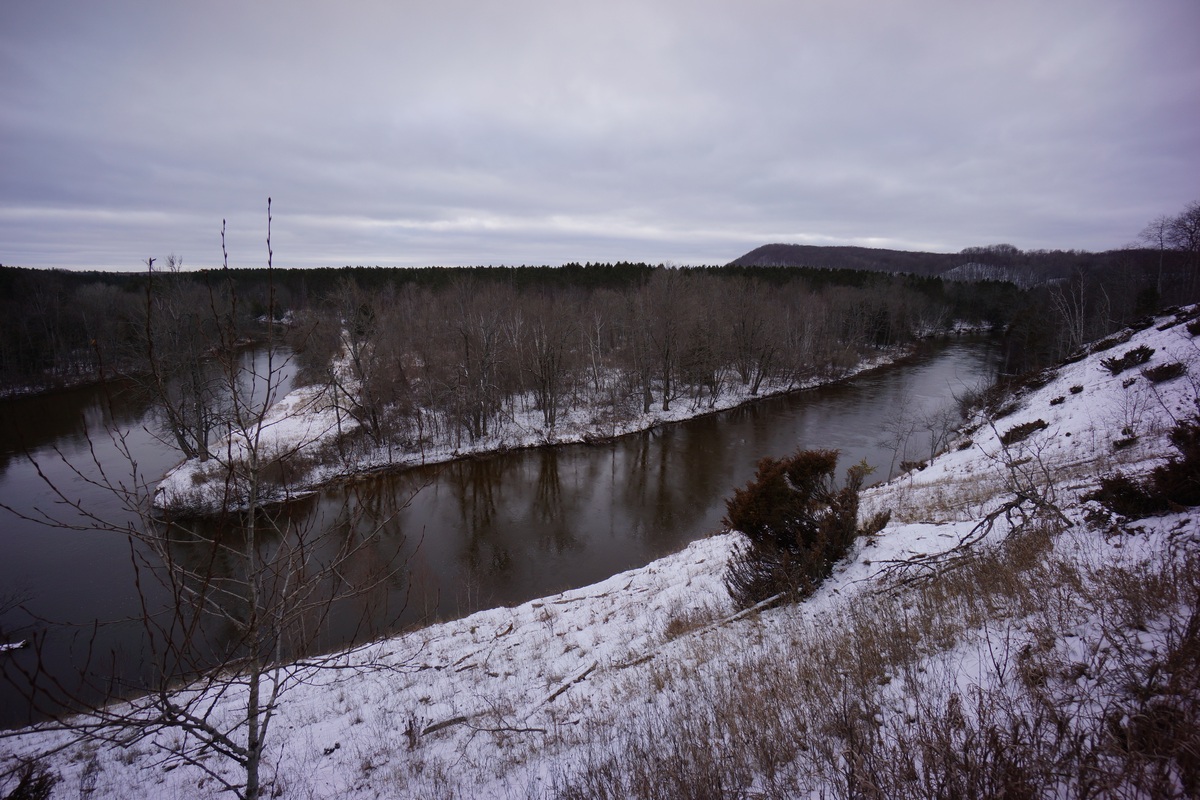
Next I arrived at the Highbanks Rollway overlook. Here, there’s a wooden platform extending over the edges of the bluffs for a great view of the Manistee River and the the surrounding area. There was a sign up here that said it’s 200ft above the river, a massive view for the lower peninsula of Michigan. You could actually see a ways in the distance from here.

View from Highbanks Rollway
After leaving the Highbanks Rollway, the trail continued to follow the edges of the bluffs and good views ensued. I was ready to find a campsite, but was looking to be a little farther away from this area. I went around another bend in the river and felt like that was far enough, and started actively searching for a place to hang my hammock.

Sign near Highbanks Rollway

West of Highbanks Rollway
When I found a place to camp, first thing I did was get a fire going. It was cold just sitting around and and I wanted the warm of the fire to warm my hands as I set up camp.

After getting the fire going, I got the hammock up and decided to leave the tarp off and chance it. There was no mention of snow tonight so I figured it was a chance worth taking. Not messing with that tarp saved a lot of time.

For dinner, I had sausage (cooked it at home and ground it up pretty good) and shredded cheddar cheese in some flatbread. It was wrapped in some aluminium foil, so all I had to do is throw it n the fire for a bit to warm it up. When it was soft to the touch, it’s done. And DAMN, was this thing good. I’m going to make more of these in the future when the temperature allows.
Before jumping in bed I put my boots in a garbage bag so that I could sleep with them under my top quilt. Frozen boots are NOT fun, lesson learned from my previous winter hike in January 2015.
Sunday December 20th, 2015
It was a cold night, in the teens. However, I was fairly warm all night with what I had. And the best part is, my boots were really warm when I put them on this morning.
After getting out of the hammock I headed down to the river overlook a few hundred yards away to watch a beautiful sunrise. Lots of reds and oranges, very colorful compared to the bright white that dominates most of the landscape.
Sunrise over the Manistee River
After watching the sunrise, eating breakfast and packing up I got a move on. It was overcast now and waiting for the warm up. In fact, it was supposed to warm up to around 40 today. I wanted to cover some ground before things softened up and became slippery and muddy. For now everything was good underfoot.

The trial continues to look and feel like it did yesterday. Some high banks with good views above the river and some lowlands here, passing through old logging fields that have been replanted or maybe alongside the river itself.


Occasionally near the river, there would be an access road leading to it. In some spots it looks like people just car camp there. I only saw one spot with some trash and it was minimal. I wondered if the fishing was any good from any of these spots by the river. Between Hodenpyl Dam and Red Bridge, roughly 15 miles southwest of here where I’ve hiked several time before, I never had any luck from the shore.

It was definitely warming up now. The clouds appeared to be thinning and although still overcast, more sun was bleeding through. Yesterday when I was hiking, it was much colder, and so having my base layer pants on underneath my hiking pants kept me at a pretty good temperature. Today though, I was sweating. A lot. I should have just stopped and removed them, but I kept pushing on. My decision ultimately ended up resulting in a good bit of chaffing, which always sucks.


I knew I had to be getting close to my car at this point. The ground was getting getting soft now and the snow was melting. Eventually, I walked through a small dirt parking lot area alongside a road, with a sign at the trailhead. Cool, there’s my car. It was early afternoon now, and I was ready to get these boots off! 25+ miles in less than 36 hours, not bad. Hopefully I’m ready for Big Bend National Park next month.
Sign at the 12/15 Rd trailhead


